
The granites of the South-West come from a number of areas of igneous activity from 100s of millions of years ago that produced large areas of granites called plutons. Humans long ago discovered the use of this granite for building, originally using ‘moorstone’ but increasingly through quarrying. The area with the most mines was the Carmenellis pluton near Falmouth and it’s an fascinating area for quarry hunting and it’s connections to building London.
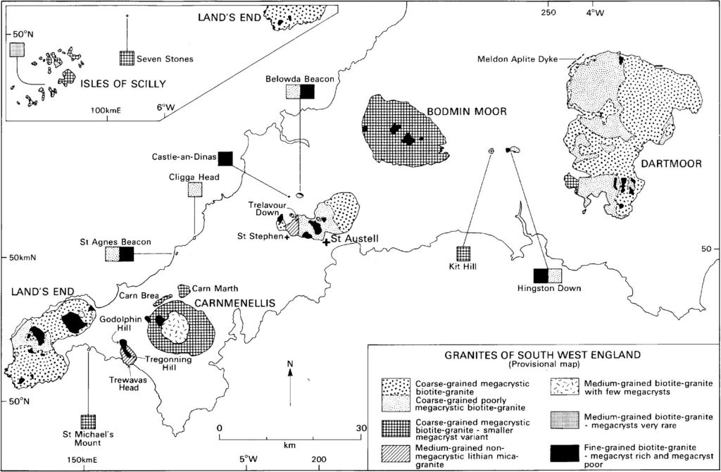
Colin Bristow’s The Geology of the Building and Decorative Stones of Cornwall on Granites and Elvans is awesome for learning about this. His 2 maps below show the 5 main areas, Land’s End, Carnmenellis, St Austell, Bodmin and Dartmoor, and a more closely focused map of the Carnmenellis area. [1]

Also check out Peter Stanier’s comprehensive “The granite industry of South-West England, 1800-1980: A study in historical geography.” [7] Stanier has since written a number of great books on Cornish and South West England quarrying and geology.
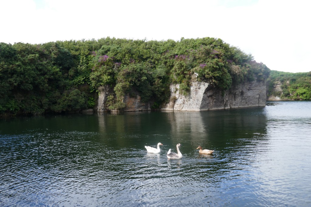
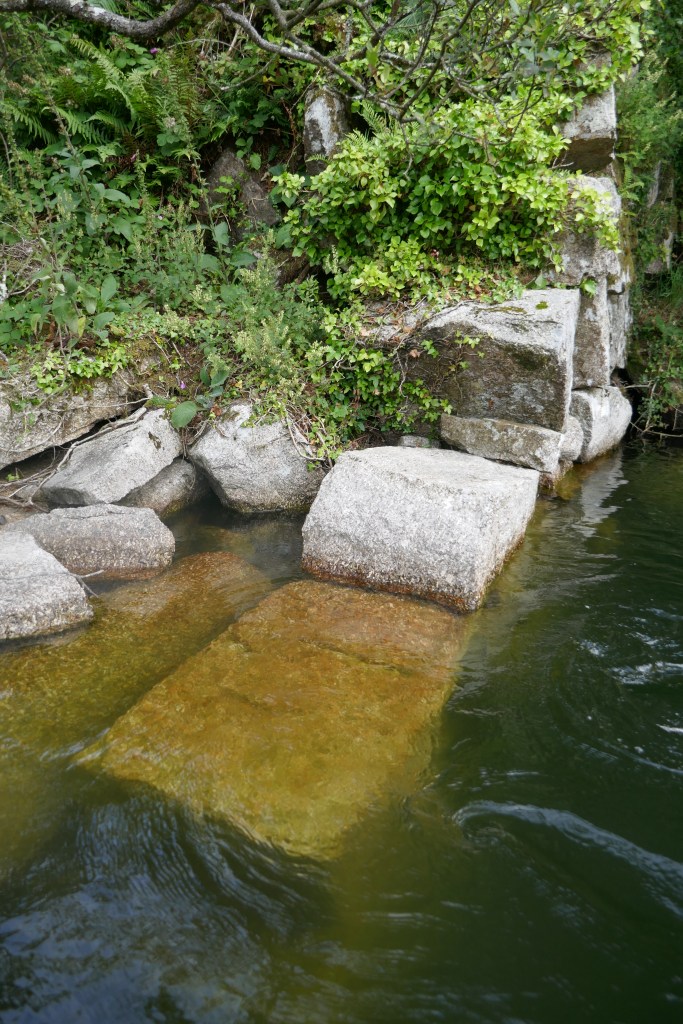
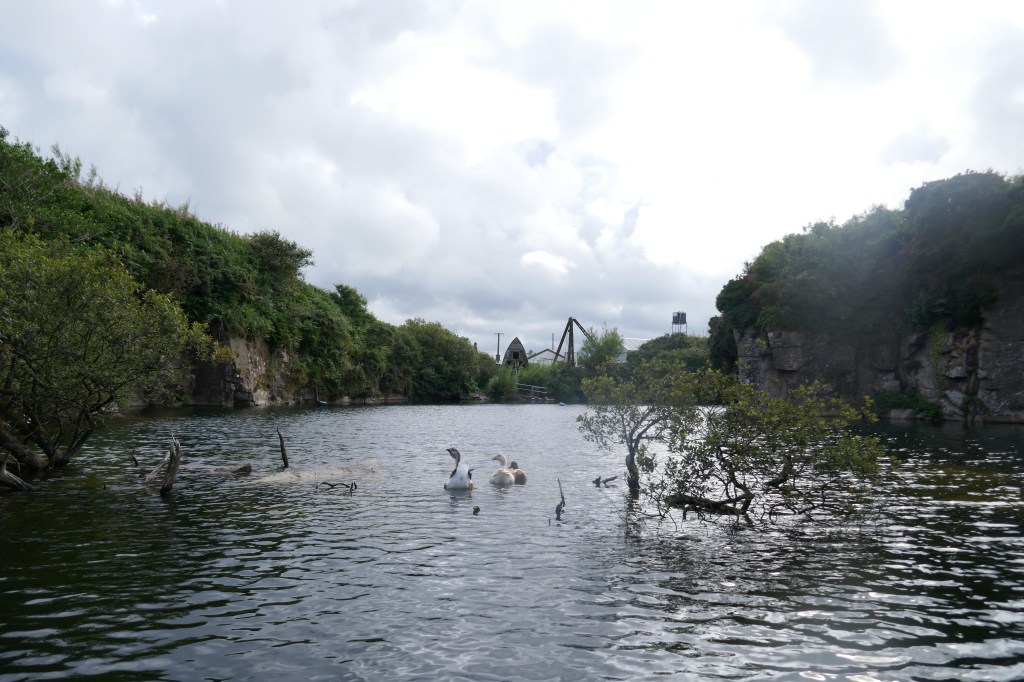
While there are 20 granite quarries on this map, there are many more smaller quarries in the area between Long Downs and Constantine. Look at the OS Explorer map of the area and you’ll start to see the blue ponds that indicate the long abandoned quarries. There’s still 2 large quarries in operation at Carnsew and Chywoon that now mainly produce aggregate for concrete, roads and railways.
I was very lucky that my friend Zoe knows Richard who owns Lower Trolvis [ the old quarries were sold for next to nothing decades ago ] and enthusiastically showed me around on foot and by boat! This pond is many 10s of metres deep and like many in the area well used by divers. And it was very warm!


Carnmenellis granite, as other South-West granites, was also much used in London, e.g. for John Rennies’s Waterloo bridge of 1817 [2], as foundation stones for Waterloo Station in 1848 and again for Westminster Cathedral in 1903, which London Pavement Geology has as specifically from Trolvis. [3] Ruth Siddall also finds Carnmenellis granite in the Embankment, specifically in the Thames Stairs Arch of 1868 [4] Check this out for a explanation of Cornish granites too!

When Waterloo Bridge was demolished in the 1930s much of it went to Harmondsworth Moor before dispersal and some remains there as Mark Hagan has photographed [5] and a small section of balustrade was repurposed at Lifeboat Pier. [6]
References:
[1] https://www.geolsoc.org.uk/SUP18675
[2] https://www.onlondon.co.uk/vic-keegans-lost-london-138-the-original-waterloo-bridge/
[3] http://londonpavementgeology.co.uk/location-details/?id=1201&search_field=westminster
[4] https://www.ucl.ac.uk/~ucfbrxs/Homepage/walks/Embankment.pdf
[5] https://markhaggan.com/travel/harmondsworth-moor/
[6] https://londonist.com/london/old-waterloo-bridge
[7] Stanier, Peter (1985) The granite industry of South-West England, 1800-1980: A study in historical geography. University of Southampton, Doctoral Thesis, 646pp. https://eprints.soton.ac.uk/413336/

Leave a comment