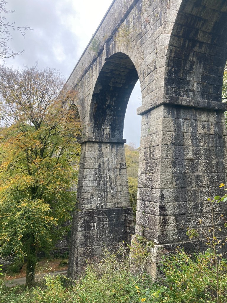
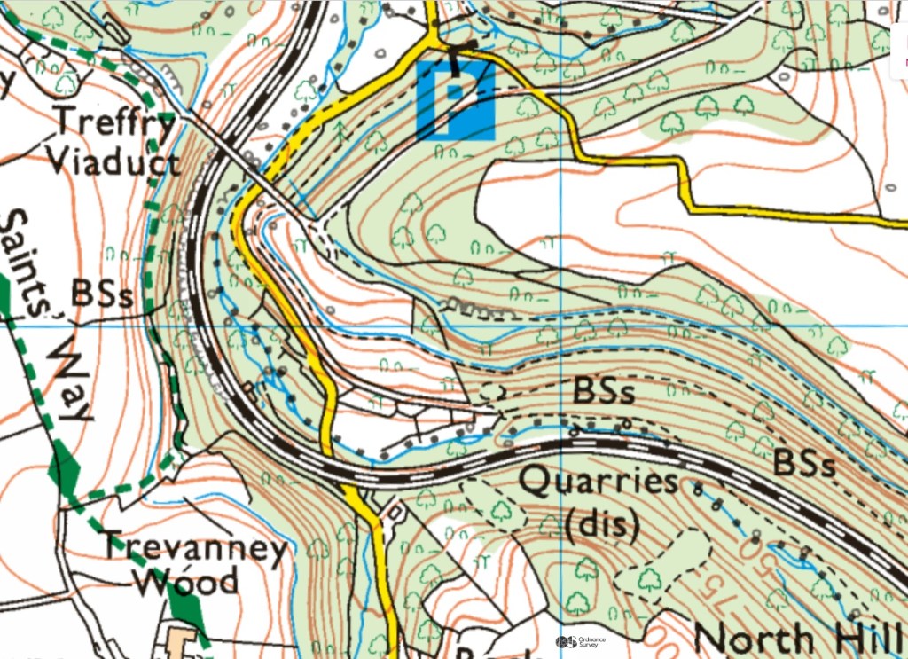
When Building London visited the awesome Luxulyan Valley, [1] “the deep and romantic gorge known as the Luxullian or Rock Valley,” [2] with it’s incredible 1842 Treffry viaduct, in 2021, as the valley was a major source of 19thC London building granite, being used in the John Rennie’s 1831 ‘New London Bridge’, now mainly in Arizona, the foundations of The Crystal Palace of 1851 and The British Museum, opening in 1855, [3] no actual quarries were visited, as they are all, well, fairly lost and overgrown. But clearly an oversight and one that needed remedying! 😀
Rock Mill Quarry
This post will be the first looking at these important quarries.
Firstly to note that the vast, flooded, inaccessible quarry north of Luxulyan, called Luxulyan Quarry on modern maps but initially Goldenpoint or Tregarden Quarry seems to be a later 19thC quarry and then only really exploited post WW2 mainly for aggregate.
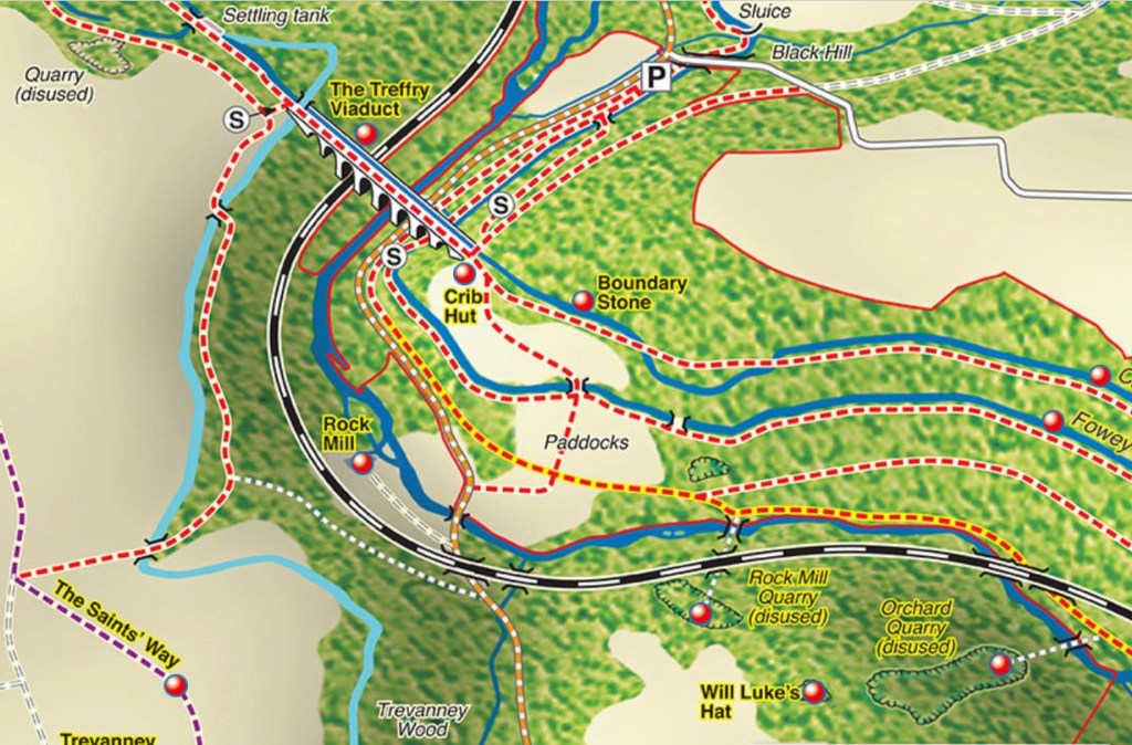
The 4 quarries that of interest re building London in the 19thC are: Carbeans and Colcerrow to the north of the river and the railway and Orchard and Rock Mill to the south.
For the history of the valley see the website of the Friends of Luxulyan Valley, who have done so much to preserve the history of the area. https://www.luxulyanvalley.co.uk/history/
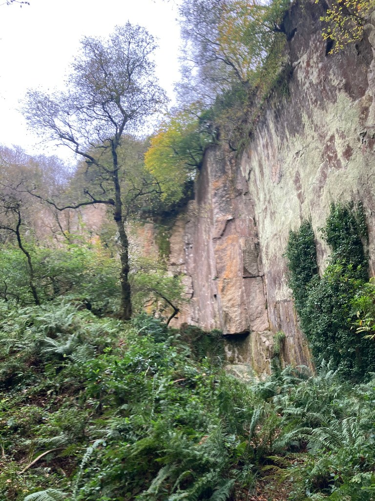
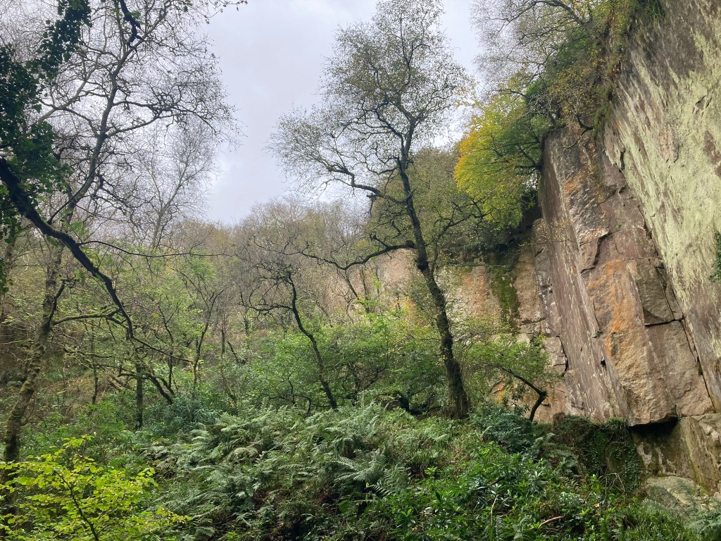
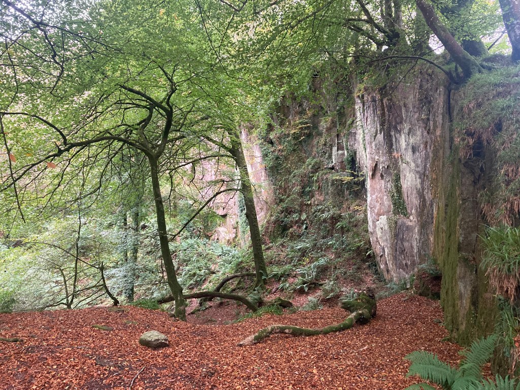
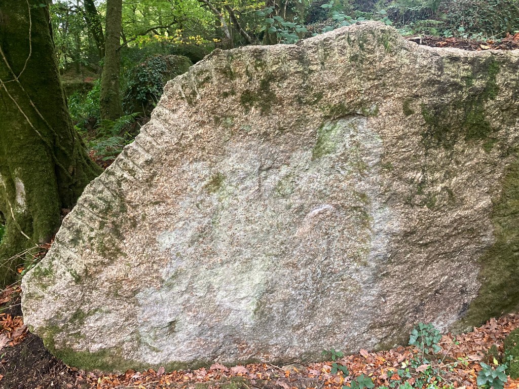
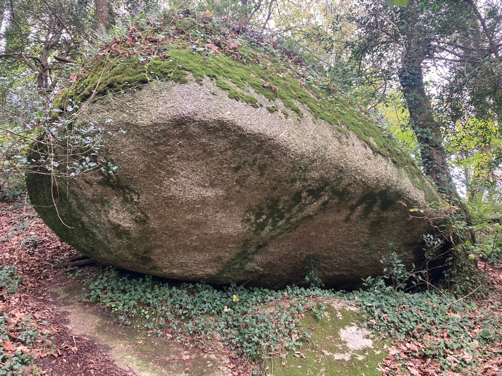
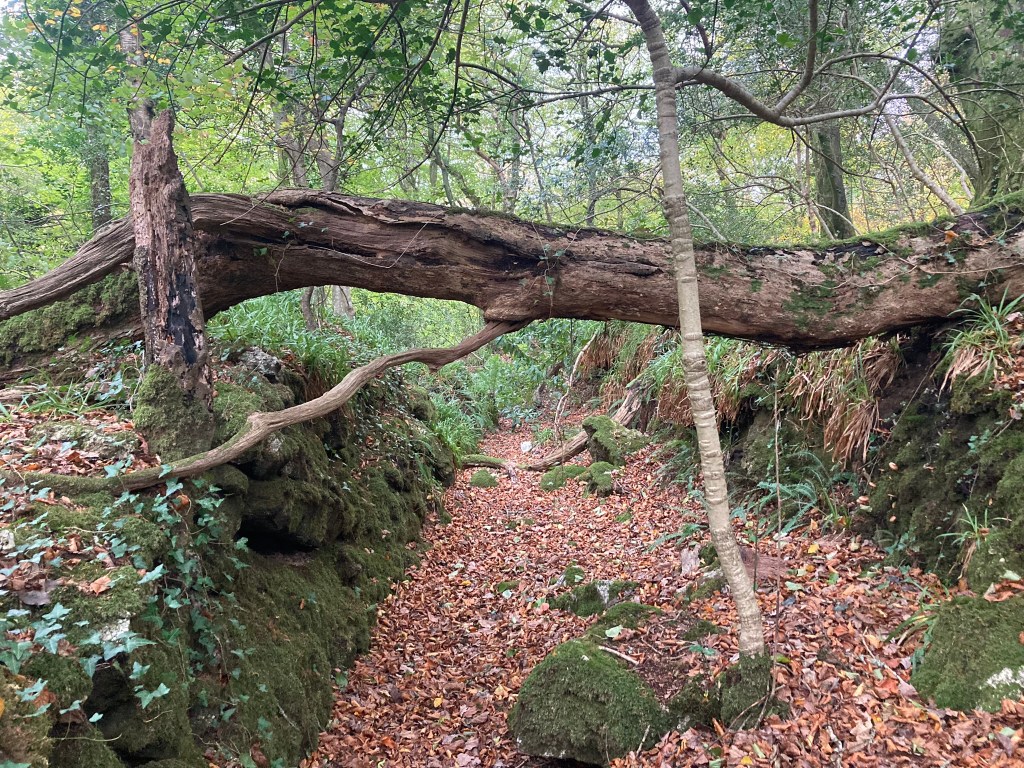
The quarry a group of us visited was Rock Mill Quarry, just south of the railway line, and named after a local water mill. Due to lack of a phone signal rendering OS Maps useless, and not having downloaded the local area, we entered via the road, not from the tramway and under the railway. Actually probably better as that was very wet!
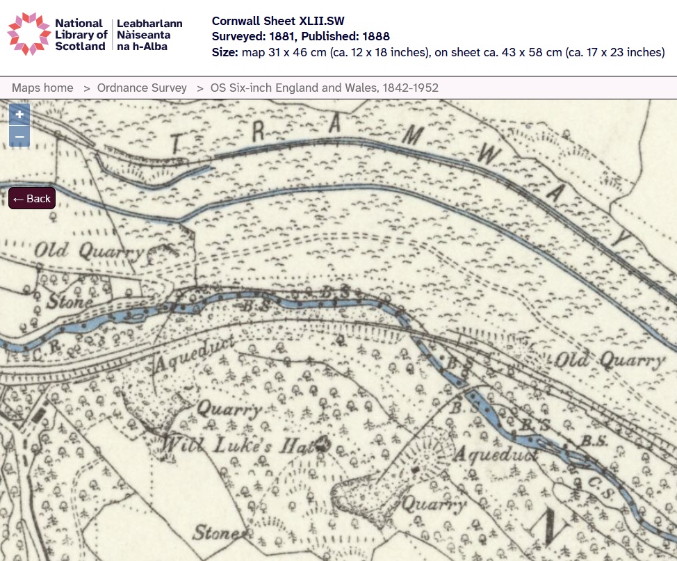
Rock Mill has probably not been quarried since the late 19thC. It doesn’t appear any bigger now than on the NLS/OS maps of 1881/1888 when we can see it and it’s neighbour linked to the tranway system. It’s not clear when Rock Mill was first quarried but possibly in the 1840s or 1850s.
Luxulyan Valley is famous for it’s massive weathered rocks and it is said that before 1840, when quarrying started, that it was these that were used for dimension stones. And 1840 quarrying does mean stone from Rock Mill could have been used at the Crystal Palace and in the foundations of the British Museum, but not for London Bridge. [4]

The tramways:
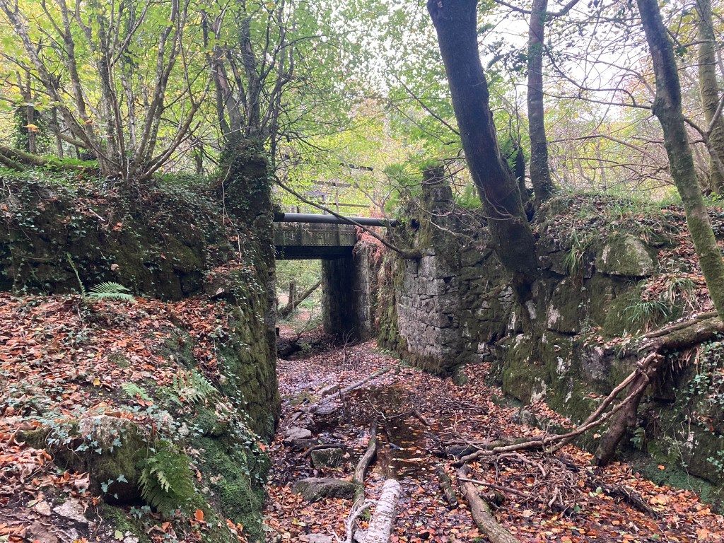
Rock Mill Quarry was connected to the Treffry Tramways [5] down to Ponts Mill basin on the Par River [6] which allowed boats to take the granite down to a sea port at Par. [7] [8]. In 1847 a canal was openned running parallel to the river [9] and in 1855 the tramway was extended down to the harbour at Par. [10]
The Friends of Luxulyan Valley state that “The Rock Mill and Orchard Quarry Tramway was built between1867 and 1870 by the South Cornwall Granite Co. to enable access to their quarries at Orchard and Rock Mill.” [17]
This article by Roger Farnworth also covers this well and suggests the port at Par opened in 1829 “Par Harbour was built in 1829 by a local entrepreneur Joseph Thomas Treffry who was known as the “King of Mid Cornwall”.” Which fits with supplying stone to London Bridge but also suggests it wasn’t used for the earlier Waterloo Bridge as some sources say. Some sources also say the harbour didn’t open till 1833 which is confusing. [8] Maybe a wharf preceded the the full harbour. [12]
Long sections of the canal can still be seen.
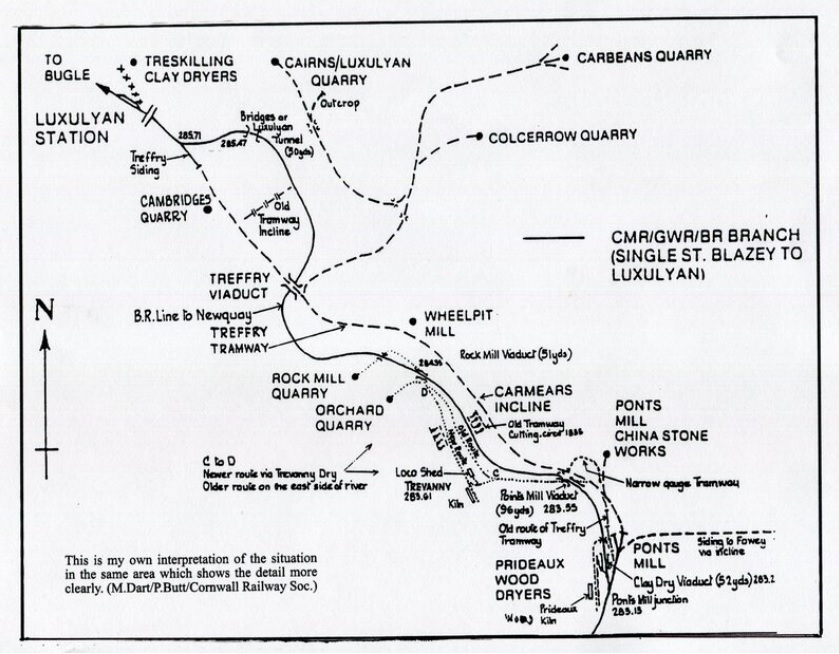
The Friends of Luxulyan Valley map shows the tramways as does the OS/NLS map of 1888 and the Cornish Railway Society have a great map and photos from 1974 of some of remnants of tramways. [12]
And it is possible that Rock Mill Quarry was also connected to the standard gauge railway which at this point is neither on an embankment, viaduct nor cutting.
Theres also appearred to be an excavated track running south fron Rock Mill Quarry towards Orchard Quarry but it was pretty much blocked with fallen trees. Maybe they were once connected?
Peter Stanier states “Two quarries, worked by the Orchard Granite Co. and the South Cornwall Granite Co., also had a direct rail link. Situated on the west side of the Luxulyan valley, they were connected by the Ponts Mill Tramway (1.6 km), which was built at the end of 1867. Each quarry had a siding, but only one was still in use in 1905.” [13]
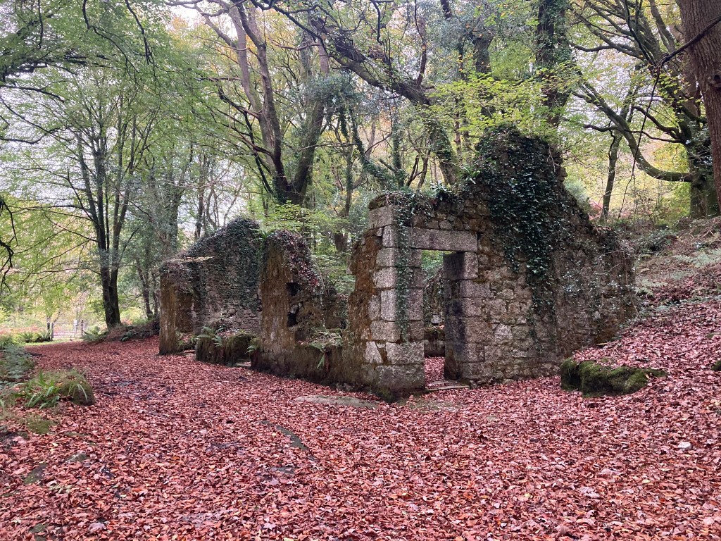
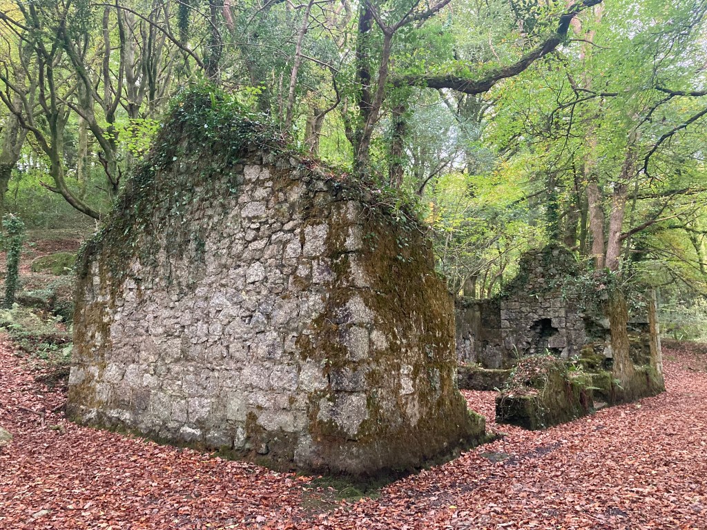
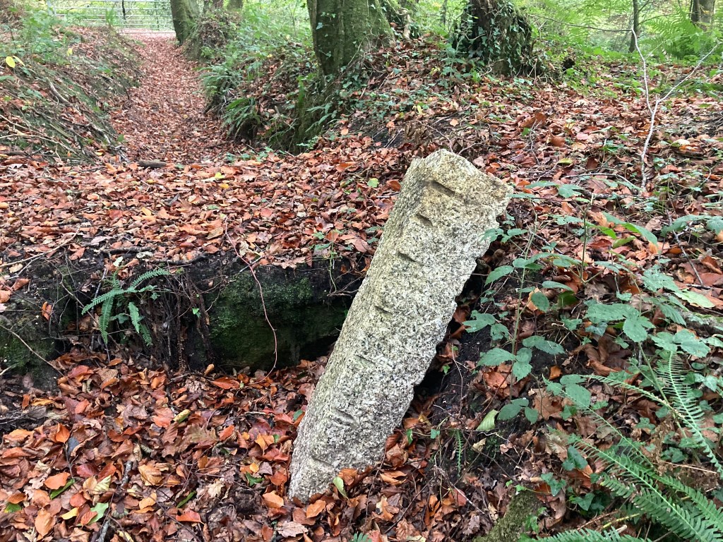
There’s not that much to see except some amazing quarry cliff faces, and this old building, almost certainly related to the quarry, though maybe also the railway. Friends of Luxulyan Valley suggest the building was a smithy and offices. [17] Jon Hird from Cornwall Railway Society says that locally this is called ‘the old blacksmiths shop’ though isn’t sure it was actually that though that fits with FofLV calling it a smithy.
St Austel or Hensbarrow Granite:
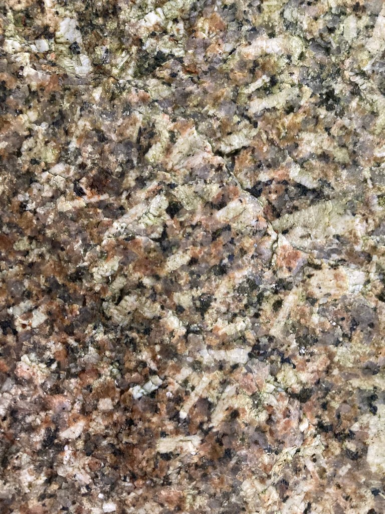
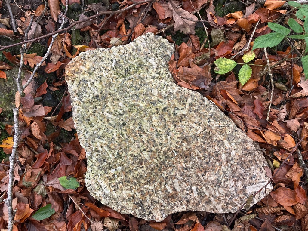
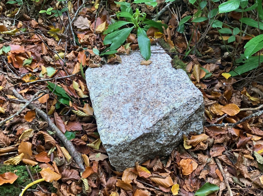
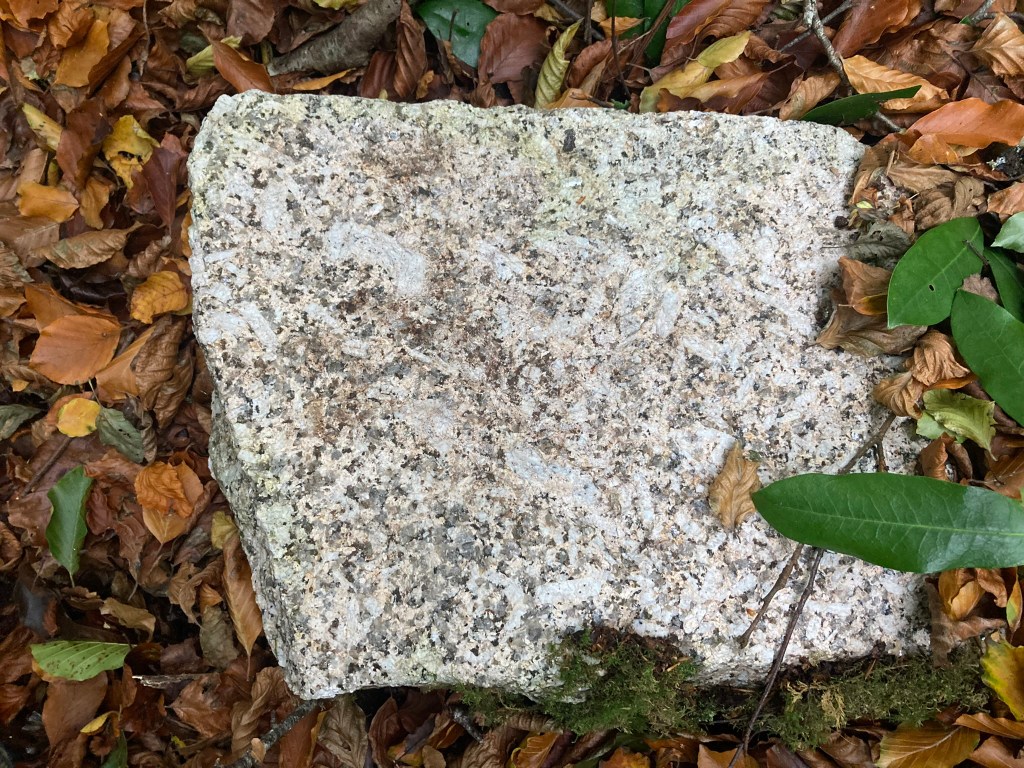
Luxulyan granite is quiet localised and part of the St Austell pluton
“Luxulyan Granite is a pale-coloured, coarse-grained, biotite granite from the eastern part of the St Austell pluton. It contains conspicuous large megacrysts of white feldspar.” [14]
“The St Austell granite is the most complex of the granite plutons forming the Cornubian batholith. The eastern part around Helman Tor and Luxulyan is a very coarse-grained biotite granite that was intruded around 285 million years ago. The granite is coarsely megacrystic with large orthoclase crystals up to 15 cm in length, which makes it an attractive dimension stone.” [15]
The Friends of Luxulyan Valley, who have done such great work, have a great website and a brilliant online map.
See here https://www.luxulyanvalley.co.uk/
Visting: Rock Mill Quarry is an abandonned quarry and like all abandonned quarries potentially extremely dangerous. It was also unclear whether this site was public or private. No fences or gates were climbed to get to Rock Mill Quarry and Orchard is apparently well used for climbing. Please note other quarries in the area are strictly private and a long way from public footpaths.
Most of the Luxulyan Valley north of the railway and river though is public and full of footpaths: see the map again. It really is an amazing place! https://www.luxulyanvalley.co.uk/LuxulyanMap.html
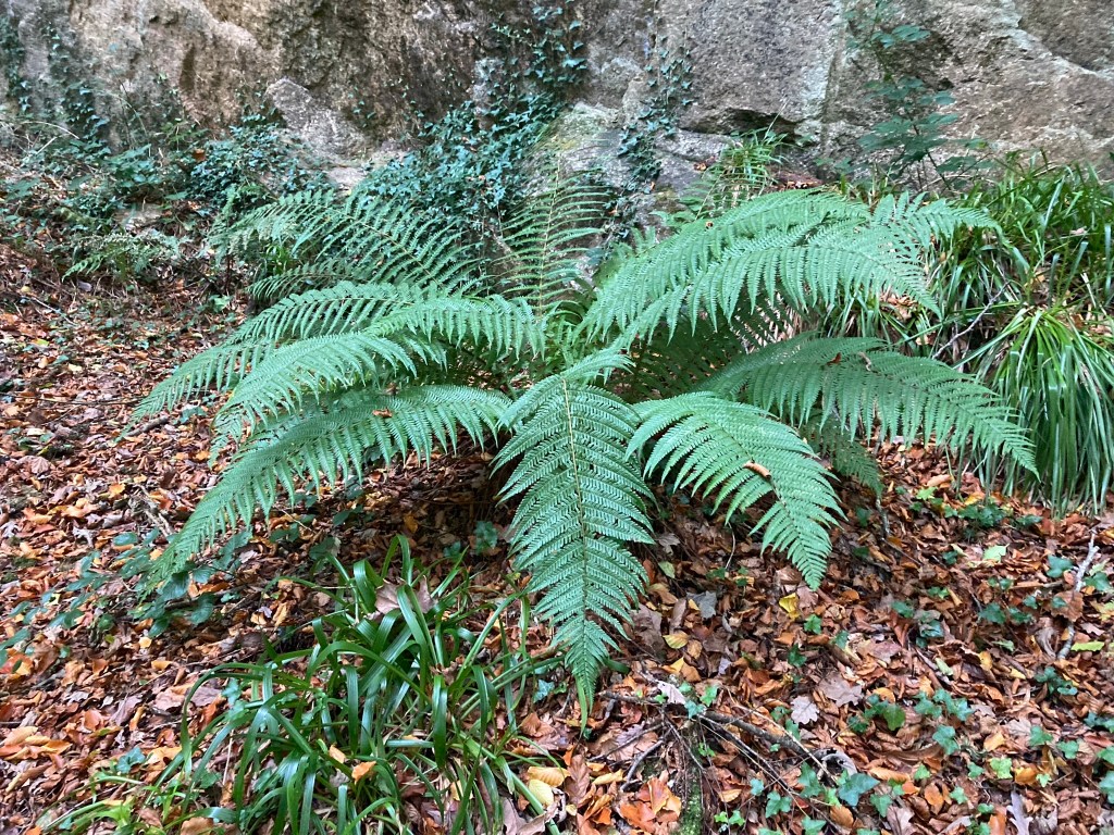
The Luxulyan Valley is not only part of the Cornish Mining World Heritage Site [16] it is a Regionally Important Geological Site [17] and over 40 species of fern have been recorded in the valley. [18]
Getting there: There is a mainline train from London Paddington to Par that takes 4 hours. And of course Par is perfect for a walk up from the old wharf/harbour, up the line of the canal and tramway. Luxulyan also has a railway station on the Atlantic Coast line from Par to Newquay. Currently the 8:03 train from Paddington would get you to Par at 12.03 and Luxulyan at 12:27 and then a walk through and around the valley taking in a couple of quarries and the inclines and Wheelpit Mill could be done in a few hours and a train back to London. So a possible day trip! Except it’s £200 for a day return. Probably best to make this part of a wider trip to Cornwall!
Luxulyan is also very close to The Eden Project so a combined visit would work very well!
There is car parking at Pont’s Mill and just north of the Treffry Viaduct – see OS maps.
References:
[1] https://buildinglondon.blog/2021/08/18/9-luxulyan/
[2] The Hensbarrow granite district J.H. Collins1878
https://archive.org/details/hensbarrowgranit0000coll/page/2/mode/2up
[3] ‘The Geology of the Country Around Bodmin and St. Austell’ William Augustus Edmond Ussher 1909
https://archive.org/details/cu31924004731430/page/n185/mode/2up?q=palace
[4] https://www.luxulyanvalley.co.uk/history/
[5] https://en.wikipedia.org/wiki/Treffry_Tramways
[6] https://en.wikipedia.org/wiki/Par_River,_Cornwall
[7] https://en.wikipedia.org/wiki/Par,_Cornwall
[8] https://en.wikipedia.org/wiki/Par_Docks
[9] https://www.cornwall-calling.co.uk/mines/tramways/par-canal.htm [10] https://www.cornwall-calling.co.uk/mines/tramways/par-railway.htm
[11] https://en.wikipedia.org/wiki/Par_Docks
https://rogerfarnworth.com/2025/02/01/the-cornwall-minerals-railway-part-2-par-its-harbour-and-st-blazey-engine-shed/
[12] https://www.cornwallrailwaysociety.org.uk/treffry-tramways.html
[13] Stanier, Peter (1985) The granite industry of South-West England, 1800-1980: A study in historical geography https://eprints.soton.ac.uk/413336/1/85075041.pdf
[14] https://historicengland.org.uk/images-books/publications/building-stones-england-cornwall-isles-of-scilly/bse-cornwall-isles-of-scilly/
[15] https://www.geolsoc.org.uk/~/media/Files/GSL/shared/Sup_pubs/2013/18675_file.rtf
[16] https://www.cornishmining.org.uk/areas/luxulyan-valley-with-charlestown
[17] https://www.luxulyanvalley.co.uk/cmp/CMP-text-July%20_final_.pdf
[18] https://explorecornwall.uk/attractions/luxulyan-valley-treffry-viaduct/

Leave a comment